Transform your smartphone into a robust off-road GPS with AlpineQuest, using offline topographic maps for your adventures. With **no advertisements, no data sharing or monetization, and no analytics or third-party libraries**, you can enjoy a truly private experience.
AlpineQuest is the ultimate tool for a wide range of outdoor activities and sports, including hiking, running, trailing, hunting, sailing, geocaching, and off-road navigation. You can access and store a variety of **online topographic maps locally**, ensuring they are available even when you're out of cell coverage. Additionally, AlpineQuest supports numerous **on-board file-based raster map formats**.
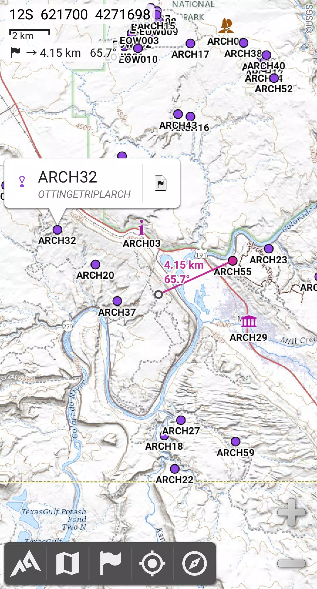
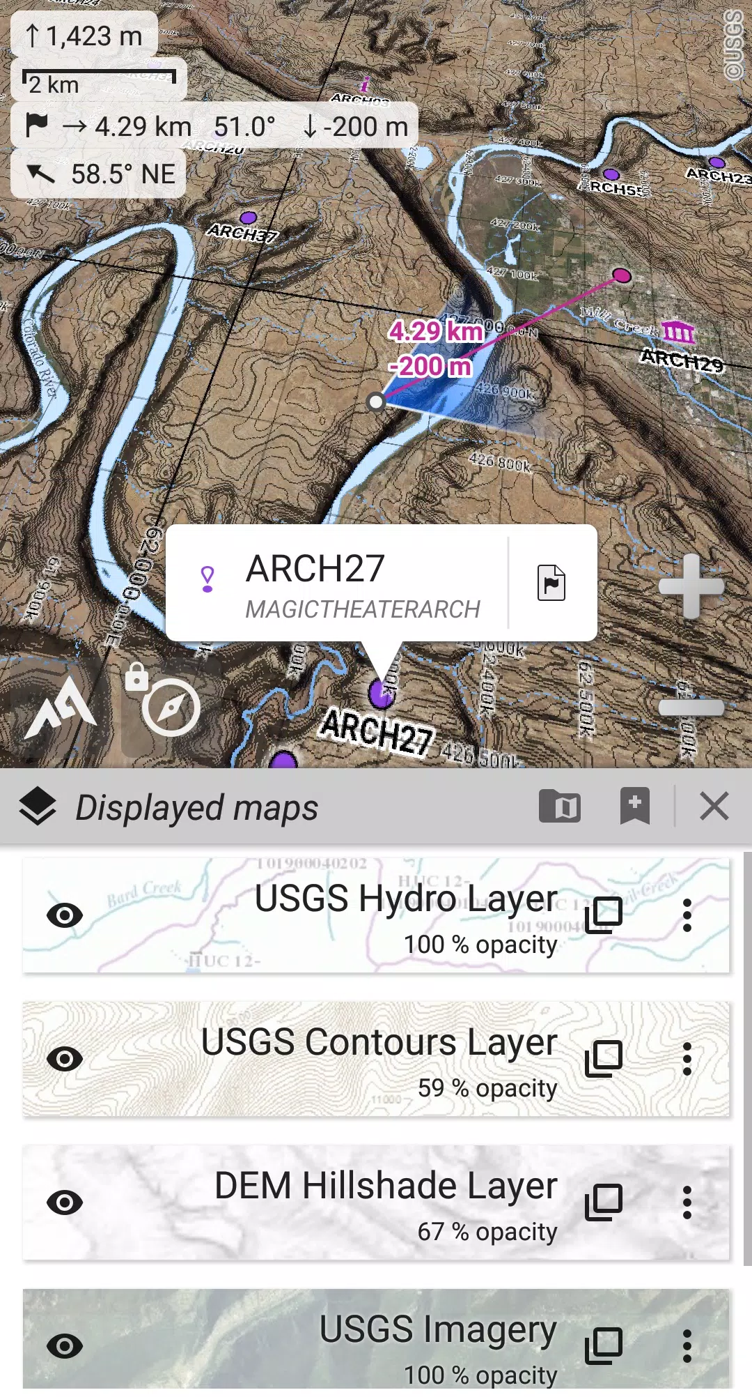
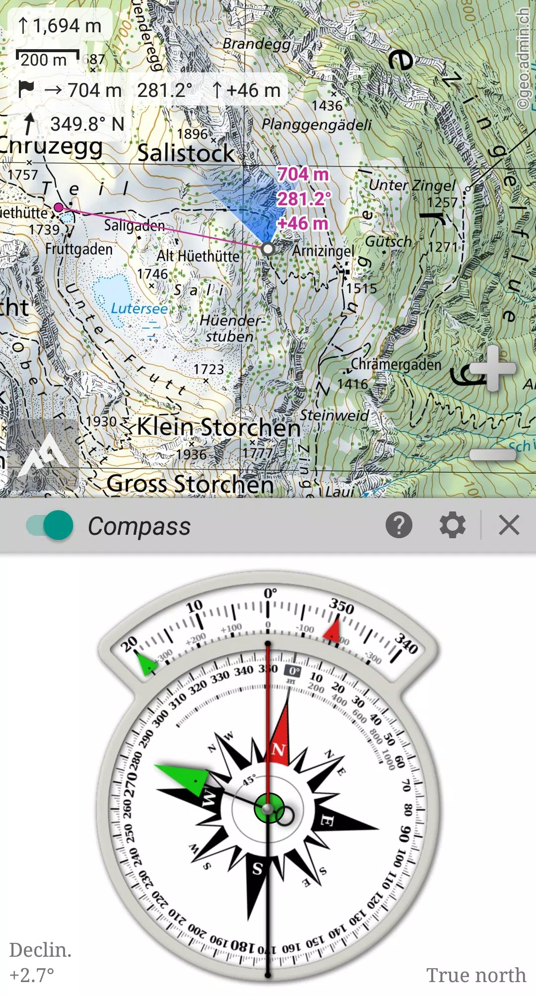
Leverage your device's GPS and magnetic sensor to stay oriented in real-time on the map, which can be rotated to align with your direction of view. This feature makes getting lost a thing of the past. You can save and retrieve an unlimited number of **placemarks**, share them with friends, **track** your routes, and access **advanced statistics** and **interactive graphics** to enhance your outdoor experience.
AlpineQuest remains fully functional even without cell coverage, making it perfect for exploring remote wilderness areas. **Download the Lite version for free** and experience its capabilities firsthand!
For any suggestions or issues, please visit our dedicated forum at https://www.alpinequest.net/forum (no registration required, all questions answered promptly) rather than leaving comments.
Key Features (Full Version)
★★ Maps ★★
- Built-in **online maps** with **automatic local storage** (including road, topo, and satellite maps) and **online layers** (road names, hillshade, contours).
- Access a wide range of additional online maps and layers with a single click from our community maps list, covering major worldwide and local topo maps.
- Complete **area storage** for offline map use.
- Support for **on-board offline maps** (raster), including **KMZ Overlays, OziExplorer OZFx2, OZFx3 (partial support), calibrated images, GeoTiff, GeoPackage GeoPkg, MbTile, SqliteDB, and TMS** zipped tiles. Visit our website to download MOBAC, the free map creator.
- **QuickChart** Memory Map support (.qct maps only, .qc3 maps not compatible).
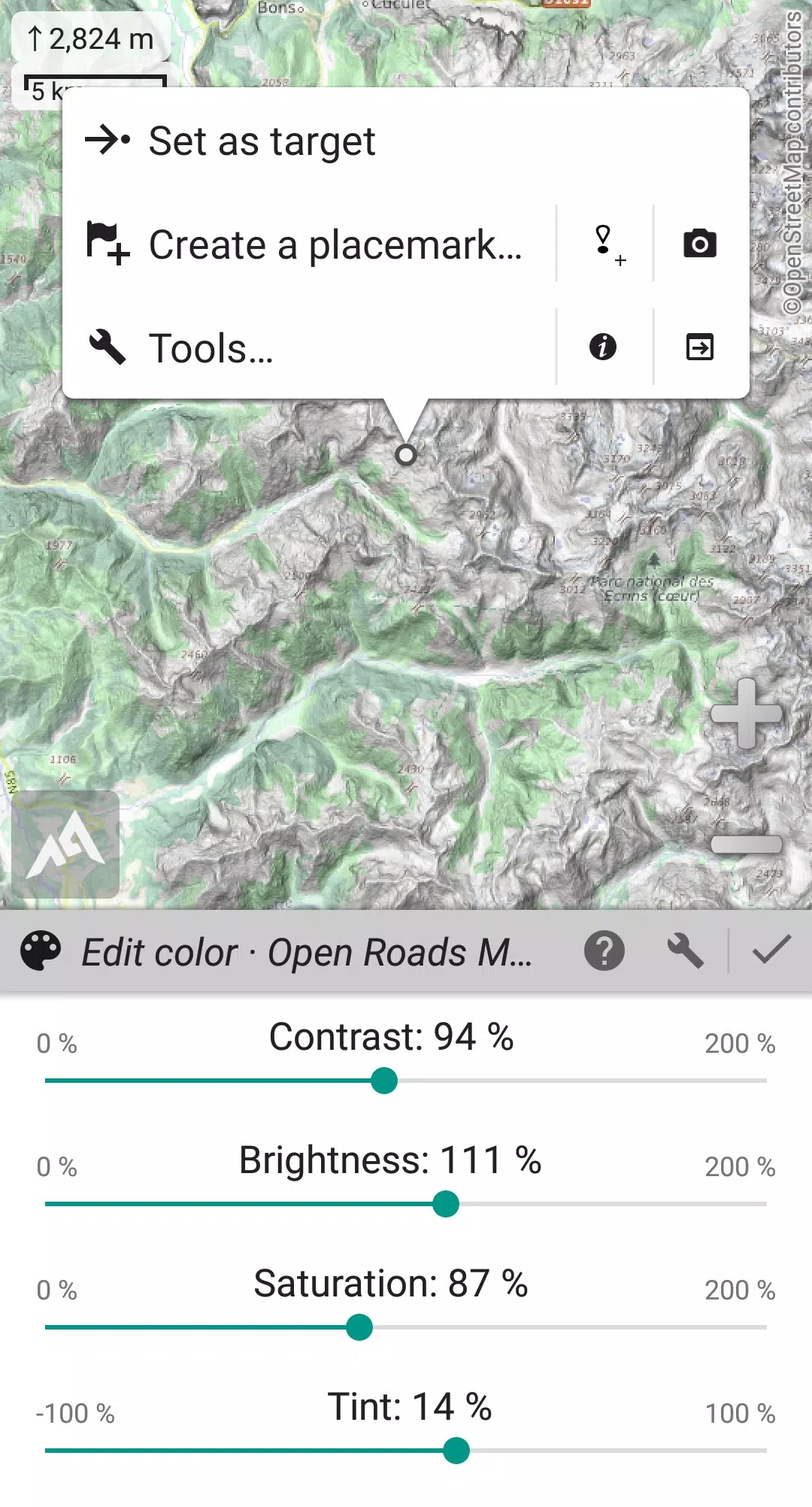
- Built-in **image calibration tool** for using any scan or picture as a map.
- **Digital elevation model** on-board storage (1-arcsec SRTM DEM) and support for **HGT** elevation files (1-arcsec and 3-arcsec resolutions) to display **terrain, hillshade, and steep slopes**.
- **Polar maps** (Arctic and Antarctic) support.
- Multiple **maps in layers** display, with control over per-map opacity, contrast, color, tint, and blending.
★★ Placemarks ★★
- Create, display, save, and restore an **unlimited number of items** including waypoints, routes, areas, and tracks.
- Import and export **GPX files, Google Earth KML/KMZ files, and CSV/TSV files**.
- Import **ShapeFile SHP/PRJ/DBF, OziExplorer WPT/PLT, GeoJSON, IGC tracks, Geocaching LOC** waypoints, and export **AutoCAD DXF files**.
- Save and share online locations using Community Placemarks.
- Access **details, advanced statistics, and interactive graphics** for various items.
- Time Controller to replay time-tagged tracks.
★★ GNSS Position / Orientation ★★
- On-map geolocation using device GNSS receivers (GPS/Glonass/Galileo/...) or Network.
- Map orientation, **compass**, and target finder features.
- Built-in **GNSS/Barometric track recorder** (capable of long tracking, runs in a separate, lightweight process) with battery level and network strength recording.
- Proximity alerts and leave path alerts.
- Barometer support on compatible devices.
★★ And More ★★
- Support for metric, imperial, nautical, and hybrid distance units.
- Latitude/Longitude and grid coordinate formats (WGS, UTM, MGRS, USNG, OSGB, SK42, Lambert, QTH, etc.) with on-map grids display.
- Import hundreds of coordinate formats from https://www.spatialreference.org.
- And much more...
What's New in the Latest Version 2.3.8d
Last updated on Aug 14, 2024
2.3.8b/c/d
- Added a new setting to customize the display style and position of the menu bar.
- Enhanced support for recent Android versions.
- Improved backup and restore tool functionality.
- New default URL for sharing coordinates as text.
- Added ability to set the application "Media" folder as the default location for placemarks, icons, pictures, and file-based maps.
- Included Croatian and Persian translations.
- Various improvements and bug fixes.