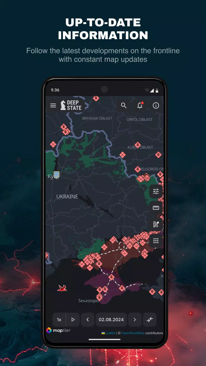
DeepStateMap.Live stands as the definitive interactive online map for tracking the hostilities in Ukraine, providing real-time insights into the Russian-Ukrainian conflict. This platform meticulously details the movements and positions of Russian units, offering a comprehensive view of the military landscape.
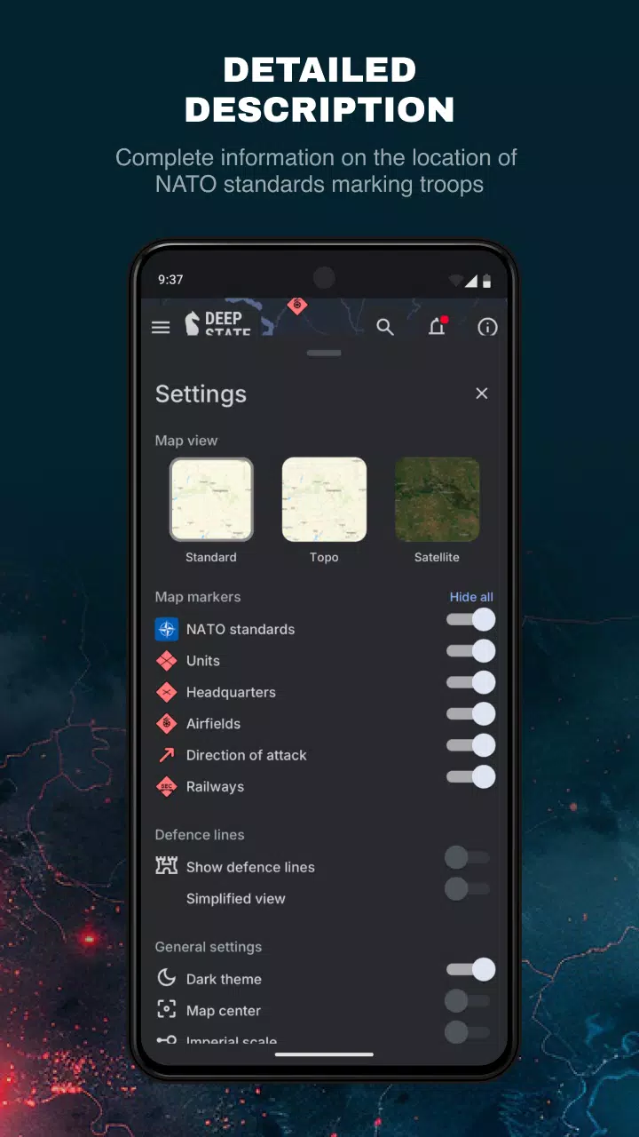
One of the key features of DeepStateMap.Live is its ability to cache downloaded data, ensuring that users can access vital information even in areas with limited internet connectivity. The map employs a variety of symbols to distinguish different territories and military assets:
- Territory of Ukraine liberated from occupation within the last two weeks
- Liberated territory
- Territory requiring further clarification
- Territory occupied by Russian troops
- Territory of the occupied Crimea and ORDLO
- Territory of Transnistria
- Locations of Russian units
- Russian headquarters
- Russian airfields
- Russian fleet
- Directions of Russian attacks
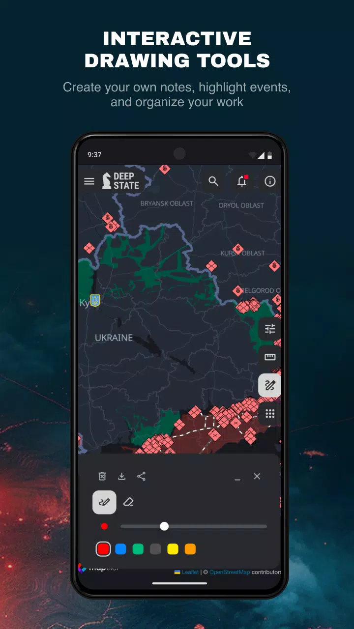
The map divides the territory into zones, color-coded for easy identification, and marks the precise locations of Russian units and airfields. In addition to its mapping capabilities, DeepStateMap.Live offers a news feed to keep users informed about the latest developments. Users can measure distances between points on the map, enhancing its utility for strategic analysis.
A unique feature of DeepStateMap.Live is its integration with the NASA Firms system, allowing users to visualize fire points and correlate them with the front line. Additionally, a special mode enables the measurement of artillery ranges for systems like HIMARS, M777, CAESAR, and others across the entire front line, providing valuable data for military analysts and enthusiasts alike.
What's New in the Latest Version 2.0.3
Last updated on Aug 13, 2024
Minor bug fixes and improvements have been implemented in the latest version. To experience these enhancements, install or update to DeepStateMap.Live version 2.0.3 today!