Are you ready? JaxReady, brought to you by the Emergency Preparedness Division and Information Technologies Division of the City of Jacksonville, Florida, is your essential tool for planning and preparing for natural disasters. This comprehensive platform assists residents in monitoring weather threats and planning evacuations effectively.
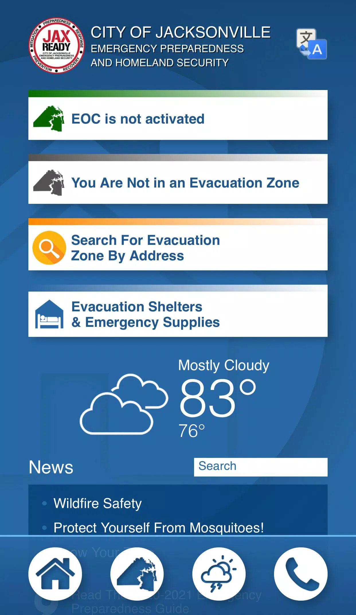
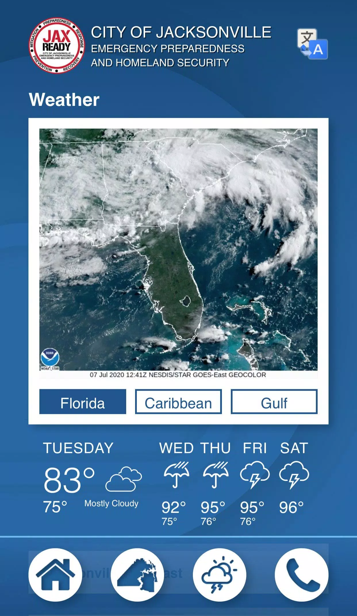
JaxReady offers real-time access to crucial information such as current threat levels, detailed weather reports, and wildfire updates, alongside up-to-the-minute news feeds for emergency preparedness and evacuation strategies.
Features:
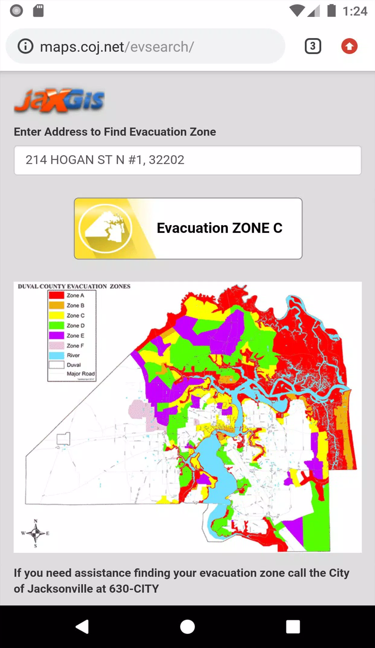
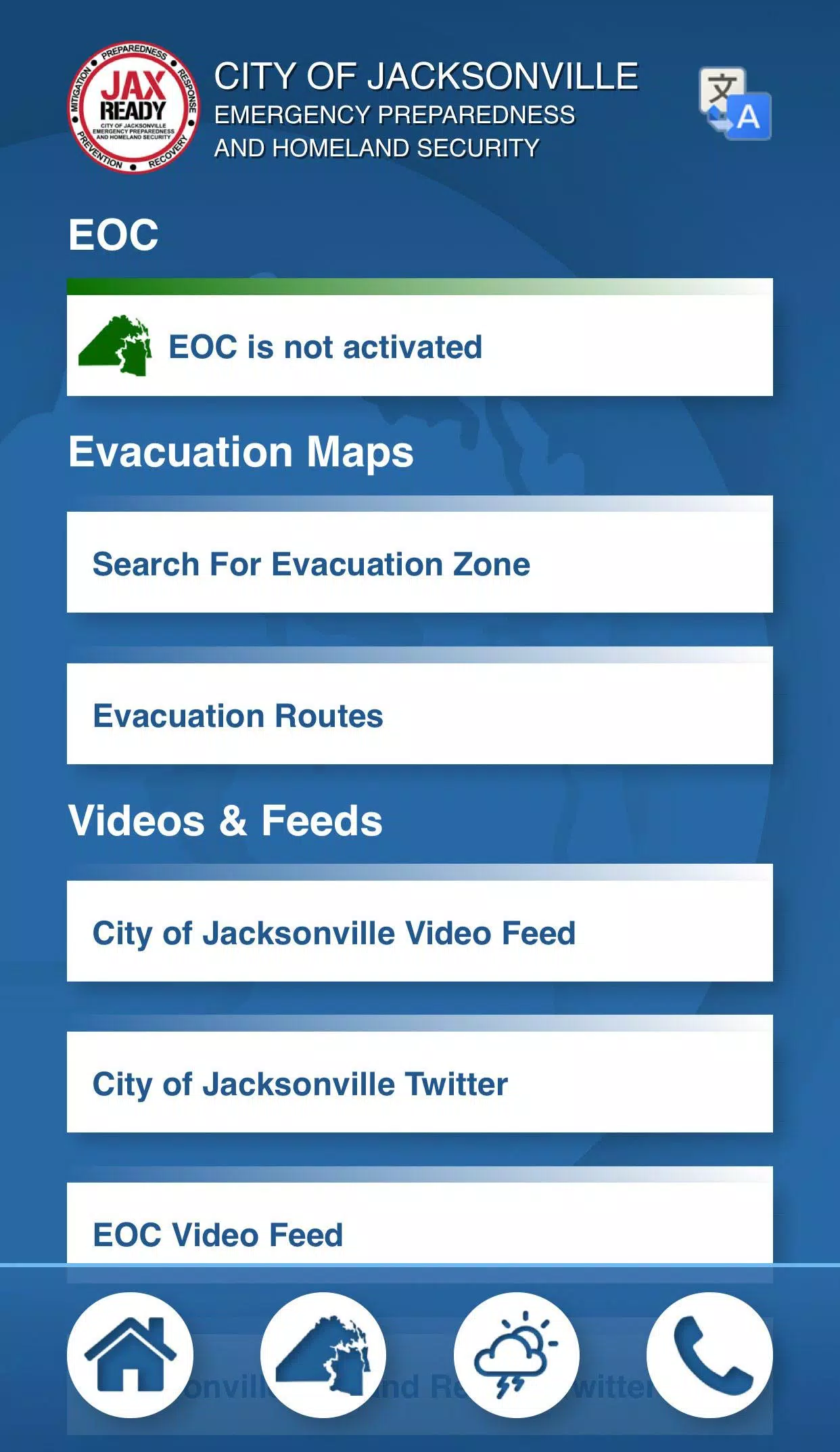
GPS Functionality: Easily locate your designated Evacuation Zone using GPS technology.
Real-Time Alerts: Get instant updates on the current Emergency Operations Center (EOC) Activation Level, Weather Threat Level, and Fire Danger Index, all tailored to your specific geolocation.
Special Needs Support: Access links to register for special needs services, ensuring those with medical requirements are well-prepared for evacuation scenarios.
Comprehensive News Feeds: Stay informed with the latest weather and fire news, helping you stay ahead of potential dangers.
Interactive Maps: View detailed maps showing weather patterns, wildfire spread, and drought indices to better understand the risks in your area.
With JaxReady, you can ensure that you and your family are well-prepared for any natural disaster that may strike Jacksonville, FL.