If you're looking for a straightforward, privacy-conscious tool to manage your KML/KMZ/GPX files, look no further than MAPinr. This ad-free Android app is your go-to for GIS management, measuring, GPS logging, WMS, and offline maps. Whether you're a professional or an enthusiast in hiking, cycling, running, skiing, or any other outdoor activity, MAPinr has you covered with its robust features.
We at MAPinr understand the rapid evolution of Android versions can be challenging for non-profit projects like ours. However, we're committed to keeping this project alive and aligned with our vision of offering a secure, privacy-friendly, and affordable app. We recognize that some devices may not support the minimum Android version required by Google. That's why we provide downloads for previous versions (below Android 14) directly from our website, ensuring you can still enjoy MAPinr even if the Play Store doesn't support your device.
Are you eager to view and manage your personal points of interest or create photomaps with your pictures? MAPinr is the simple solution you need. Here's what MAPinr offers:
- Ad-free experience
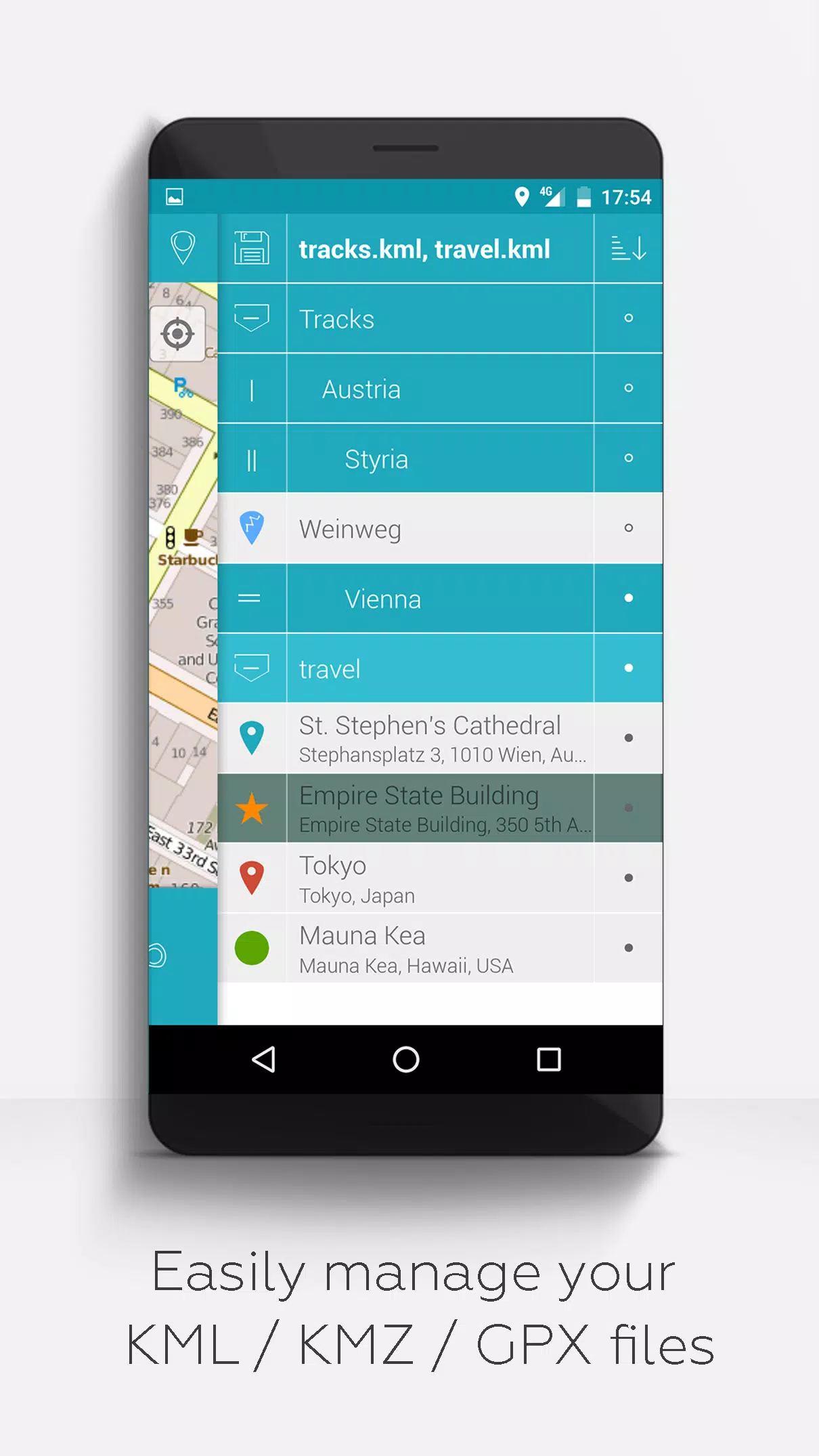
- Hierarchical folder structure for managing multiple KML/KMZ/GPX files
- Create, load, edit, save, import, export, and share KML/KMZ files
- Create, load, edit, save, import, export, and share waypoints, lines/tracks, and polygons
- Add pictures to waypoints to create photomaps
- Display waypoints, lines/tracks, and polygons on various maps (Maps, Satellite, Hybrid, OpenStreetMap, Opentopomap, Opencyclemap)
- Share coordinates of waypoints
- Individual colorization of waypoints, lines/tracks, and polygons
- Open exported KML/KMZ files in other apps
- Search by name, address, and coordinates
- Location sharing to keep friends updated on your whereabouts
- Display multiple KML/KMZ/GPX files simultaneously
- Merge KML/KMZ files
- Cloud integration
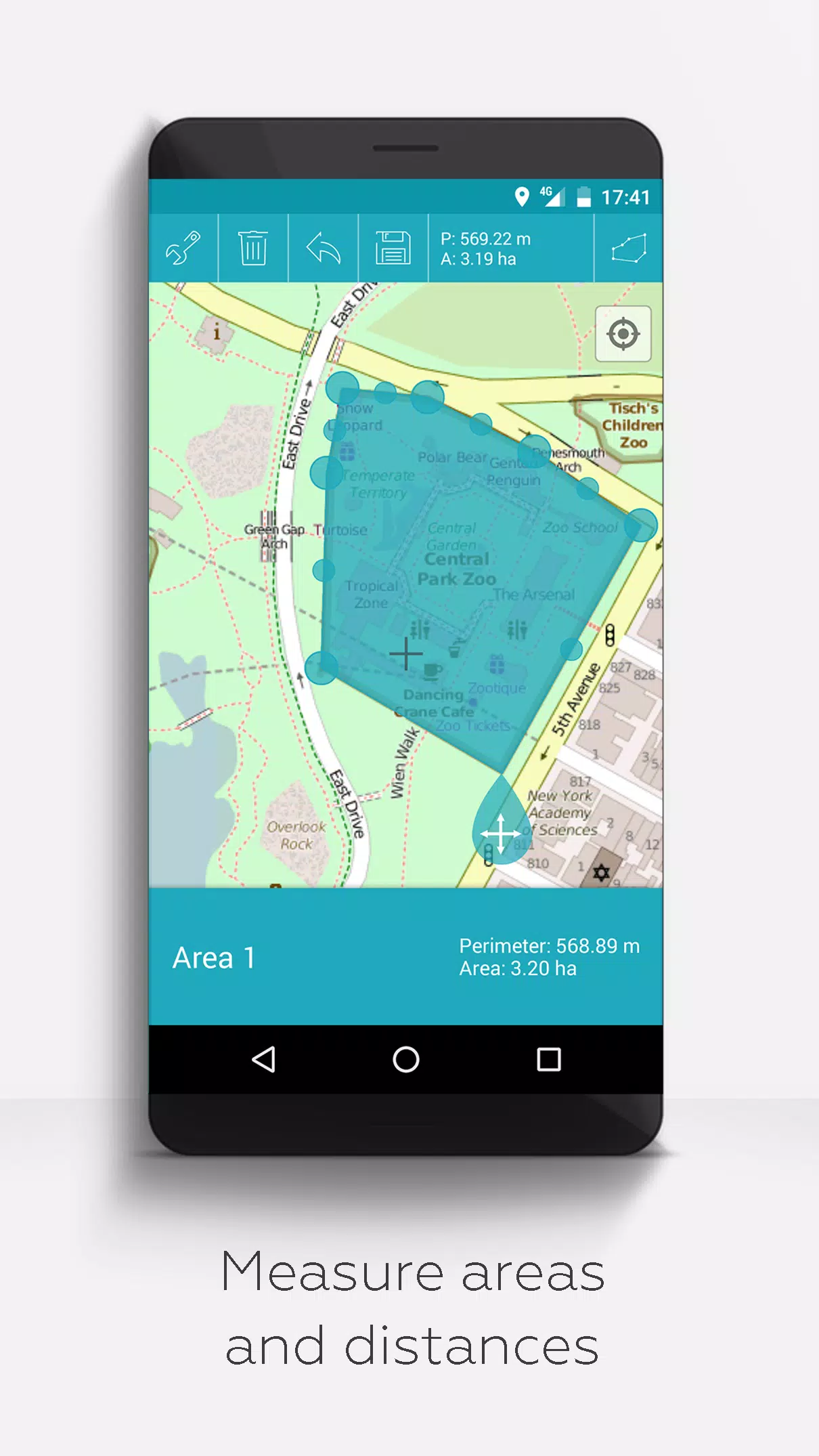
- Measure distances and areas on your map
- Multilingual support (currently English, Spanish, Lithuanian, Polish)
For those looking for even more, we offer extended features that can be activated with donations or likes on LinkedIn through the settings:
- Download free offline maps from OpenStreetMap
- GPX viewer (display GPX files only)
- Display arbitrary map data using Web Map Service (WMS), including opendata from www.data.gov
- Create custom metadata
- Upload and use custom icons
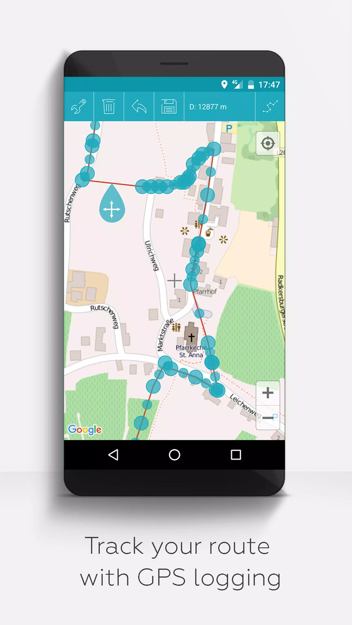
- Record GPS tracks
Unlike other apps, MAPinr respects your privacy and will not exploit your personal data. Your donations, which are entirely voluntary, help support our non-profit efforts. We value your feedback and encourage you to share your problems and ideas on how to improve MAPinr by emailing us at [email protected]. Please remember, while we strive to address all suggestions, our resources are limited, so patience and constructive feedback are appreciated.